Kumrat Valley and Katora Lake: A Complete Trekking Guide
Amel Ul Mulk
1 August 2026 · 5 min read
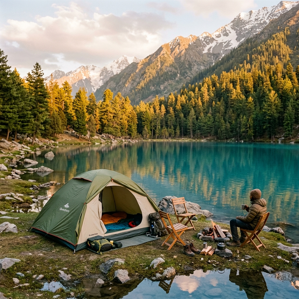
Ancient deodar cedar forests and thundering waterfalls in Upper Dir, and above them the hidden crater lake of Katora, reached by a demanding day trek from the meadows of Jahaz Banda.
The lowdown
- Location
- Kumrat Valley
- Region
- Khyber Pakhtunkhwa
- Nearest town
- Thal
- Difficulty
- Hard
- Crowd level
- Moderate
- Best season
- May to September, with July and August greenest
Kumrat is what people picture when they dream of the mountains. Rivers roaring through giant cedar forests. Wooden shepherd huts. Waterfalls everywhere. Cold, clean air. It sits at the top of Upper Dir in Khyber Pakhtunkhwa, and above it hides one of the most beautiful alpine lakes in the country, Katora Lake, a crater of turquoise water ringed by rock. Getting to the valley is easy enough. Getting to the lake will test your legs. Here is the whole thing, start to finish, honestly.
What the trip is really like
Most people spend a day or two by the river in lower Kumrat, where the forest is thick and the waterfalls are loud. Then, if they want the lake, they take a rough jeep up to the trailhead, sleep a night in the high meadows of Jahaz Banda, and climb hard the next morning to Katora. The valley part is relaxed and green. The lake part is a proper trek. Knowing that difference before you go is the single most useful thing in this guide.
Where is Kumrat?
Kumrat Valley lies in Upper Dir, in the far north of Khyber Pakhtunkhwa, near the boundary with Chitral and Swat. It is famous for its deodar (cedar) forests, some of the oldest and thickest in Pakistan, plus the Kumrat and Jahaz Banda waterfalls and the wide, cold Panjkora river. It has become popular with Pakistani families in recent years, but the higher you go, the quieter it gets.
Katora Lake, the crater in the sky
The real prize is Katora Lake, also called Jahaz Banda Lake, sitting at around 3,700 metres. It is a near-perfect bowl of clear green water with a rock amphitheatre behind it, and on a still morning the reflection is unreal. It is not a gentle stroll. From the meadows of Jahaz Banda it is a steep, rocky 4 to 6 hour climb each way, gaining serious height. Bilkul asan nahi hai, but it is worth every hard step.
How to get there, step by step
- Islamabad to Thal (about 10 to 12 hours). Drive north via Timergara and Dir to the village of Thal in Upper Dir, the gateway to Kumrat. Most people break this long journey partway.
- Thal to Kumrat and the trailhead (rough 4x4). From Thal, local jeeps grind up a rough track into Kumrat and toward the Jahaz Banda trailhead. This is 4x4 country, so hire a local jeep and driver. Do not try it in a car.
- Trailhead to Jahaz Banda (2 to 3 hours on foot). A walk up to the high meadows, where you sleep before the lake.
- Jahaz Banda to Katora Lake (4 to 6 hours each way). The steep climb to the lake. Take a guide, and a mule for your bag if you want to enjoy the walk.
When to go
The season runs May to September, and the valley is at its greenest and most alive in July and August. Katora Lake usually clears of snow by late June. Avoid the peak monsoon window if you can, because the tracks turn to mud and there is a real risk of landslides on the Dir road. By October the nights are bitterly cold and the higher trails start to close.
Where to stay
In lower Kumrat there are riverside campsites, wooden huts, and a few basic hotels. Up at Jahaz Banda you will find simple shepherd-style guesthouses and tent camps, which is exactly where you want to sleep the night before the lake climb. Everything up here is basic, with limited power and no real signal, so plan for that. On busy summer weekends, book ahead or arrive early.
Food, cash, and signal
Lower Kumrat has simple dhabas serving hot, basic food. Higher up, meals are simple and limited, so carry snacks and enough water. There are no ATMs in the valley, so bring all the cash you will need for jeeps, guides, huts, and food. Mobile signal is patchy to nonexistent past the lower valley, so download offline maps and tell someone your plan before you lose coverage.
Fitness, altitude, and safety
Let us be honest. The valley itself is gentle, but the Katora Lake trek is genuinely hard, a long steep climb to 3,700 metres. You want decent fitness and broken-in boots. Watch for altitude on the lake day: start early, carry water and snacks, and turn back if the weather closes in, which it can do fast up there. Nights are cold even in midsummer. Hire a local guide for the lake, because the upper section is steep and unmarked and it is easy to lose the path in cloud. None of this is meant to frighten you. Prepared trekkers do this every summer and love it.
What to pack
Warm layers and a down jacket. A waterproof shell. Sturdy trekking shoes, broken in. A headtorch. A power bank. Sunblock and sunglasses. A refillable water bottle with a way to purify. Snacks for the trail. A basic first-aid kit. And cash.
Questions people ask
How hard is the Katora Lake trek? Hard. Steep, 4 to 6 hours each way from Jahaz Banda, at real altitude. Come fit.
Do you need a guide? Yes, strongly recommended for the lake. The upper trail is unmarked and confusing in cloud.
When is best? July and August for green meadows and a snow-free lake.
Do you need a permit? No, but carry ID for checkpoints on the Dir road.
Can you just see the valley without the lake trek? Absolutely. Lower Kumrat, with its forests and waterfalls, is beautiful and easy on its own.
Kumrat and Katora sit right on the doorstep of Chitral, where our local hosts run guided treks. Browse Katora Lake and Kumrat treks, see everything around Kumrat, or explore all the Chitral and Hindu Kush trips. First time up north? Start with our season guide.
Getting there
Reach Thal in Upper Dir (about 10 to 12 hours from Islamabad via Timergara), then a rough 4x4 track to Kumrat and the Jahaz Banda trailhead. Katora Lake is a steep 4 to 6 hour trek each way from Jahaz Banda.